
Image
Q-36-143 Public Deposited
- Original Publication Date
1938
- Genre
- Topographic Maps
- Military Maps
- Location
- Coordinates: 64, 35, 64.333, 35.5
- Related URL
- Abstract
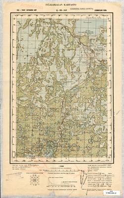
- Modern area represented: Sumskiy Posad, Republic of Karelia, Russia
- Call Number
- G7000 s100 .S7 sheet Q-36-143
- City
- Сумский Посад (Sumskiy Posad)
- Copyright Owner
- No Copyright - United States
- Country
- СССР (USSR)
- Filename
- VAC9619-002628
- Subject
- Topical Subject: Soviet Union
- Geographic Subject: Sumskiy Posad
- Topical Subject: Maps
- State/Region
- РСФСР (RSFSR)
- Карельская АССР (Karelian Autonomous Soviet Socialist Republic)
- Беломорский район (Belomorskiy district)
- Title
- Q-36-143
- Physical Description
- Scale: 1:100,000
- Language
- Russian
- Persistent Identifier
- Holding Location
- Bloomington - Herman B Wells Library
1320 E 10th St.
Bloomington, IN 47405
Contact at libref@iu.edu, (812) 855-0100
- Bloomington - Herman B Wells Library
- Campus
- IU Bloomington
- Provenance
- DMA Topographic Center, Army Map Service Library, OMAHA, Geographic Names Branch, Atlasblatt
- Publisher
- Itä-Karjalan kartasto
Relationships
Relationships
- In Collection:
Items
Show Item Images
| Thumbnail | Title | Date Uploaded | Visibility | Actions |
|---|---|---|---|---|

|
VAC9619-002628.jp2 | 2024-01-18 | Public |
|
|
VAC9619-U-002303.jp2 | 2024-01-18 | Public |
|