Department of Geology and Natural Resources of Indiana
Date Created:
1907
Identifier:
VAC3073-02059
Pages:
0-99 pages
Genre:
Maps. Mine maps.
Geographic Location:
W0854720 W0844820 N0404500 N0400900
Related URL:
https://iucat.iu.edu/catalog/16077855
Abstract:
Shows good, fair, and light oil territory, gas wells, dry holes, abandoned territory, and pumping stations. Detached from: The petroleum industry in Indiana ...
Call Number:
G4091.H8 1907 .B5
Country:
United States
Physical Description:
53 x 67 cm, folded to 22 x 12 cm and 1 map : color
Alternate Identifier:
a16077855
Holding Location:
Bloomington - Herman B Wells Library 1320 E 10th St. Bloomington, IN 47405 Contact at libref@iu.edu, (812) 855-0100
Indiana Department of Geology and Natural Resources
Date Created:
1907
Identifier:
VAC3073-02046
Pages:
0-99 pages
Genre:
Geological maps. Maps.
Geographic Location:
W0851755 W0844842 N0400023 N0391604
Related URL:
https://iucat.iu.edu/catalog/9676901
Abstract:
Detached from: The stratigraphy and paleontology of the Cincinnati series of Indiana / E.R. Cumings. In 32nd Annual report of the Indiana Department of Geolo...
Call Number:
G4091.C57 1907 .M37
Country:
United States
Physical Description:
1 map and on sheet 67 x 37 cm, folded to 20 x 13 cm
Alternate Identifier:
a9676901
Holding Location:
Bloomington - Herman B Wells Library 1320 E 10th St. Bloomington, IN 47405 Contact at libref@iu.edu, (812) 855-0100
Real property--Indiana--Gary--Maps. Gary (Ind.)--Maps.
Publisher:
Albert Jewett
Date Created:
1907
Identifier:
VAC3073-02011
Pages:
0-99 pages
Genre:
Cadastral maps.
Related URL:
https://iucat.iu.edu/catalog/12393713
Abstract:
At head: Steel works and blast furnaces, Indiana Steel Co. Includes insert "Map of Gary showing Tolleston," ill., and index. Shows subdivisions, lo...
Call Number:
G4094.G2G46 1907 .J49
City:
Gary
Country:
United States
Physical Description:
148 x 81 cm. and 1 map
Alternate Identifier:
a12393713
Holding Location:
Bloomington - Herman B Wells Library 1320 E 10th St. Bloomington, IN 47405 Contact at libref@iu.edu, (812) 855-0100
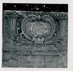
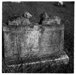
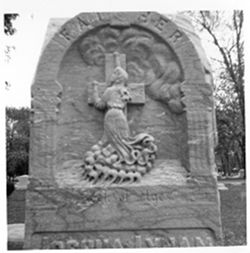
Personal Name, Age/Gender: Butcher, Arthur Wayne, inf./M, Donor's Image Number: None, Ledger Page/ Entry Number: None, Personal Name: Butcher, L. E., Dea...
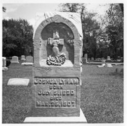
Corporate Name: Brotherhood Railway Carmen of America, The, Topical: Fraternal organizations, Topical: Graves, Topical: Hammers, and Topical: Wrenches
Series:
Groups
Creator:
Montgomery, Pauline
Date Created:
1907
Identifier:
VAE0886-001540
Pages:
0-99 pages
Abstract:
The IU Archives made inquiries into what the "M" stands for in the logo. Replies received were: 1) that is stood for "Mechanics", and 2) ...
City:
Bedford
Copyright Holder:
Indiana University
Country:
United States
Alternate Identifier:
C386
Holding Location:
Bloomington - University Archives Wells Library E460 1320 E 10th St. Bloomington, IN 47405 Contact at archives@iu.edu, 812-855-1127
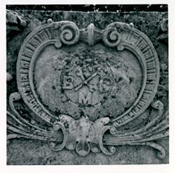
Topical: Wrenches, Topical: Hammers, Topical: Graves, and Corporate Name: Brotherhood Railway Carmen of America, The
Series:
Groups
Creator:
Montgomery, Pauline
Date Created:
1907
Identifier:
VAE0886-001539
Pages:
0-99 pages
Abstract:
The IU Archives made inquiries into what the "M" stands for in the logo. Replies received were: 1) that is stood for "Mechanics", and 2) ...
City:
Bedford
Copyright Holder:
Indiana University
Country:
United States
Alternate Identifier:
C386
Holding Location:
Bloomington - University Archives Wells Library E460 1320 E 10th St. Bloomington, IN 47405 Contact at archives@iu.edu, 812-855-1127


![[there is no ledger entry for this image]](https://iiif.uits.iu.edu/iiif/2/hm50vm13c%2Ffiles%2Fe6e7c96f-84e7-410b-82f5-4a3292a7fcee/full/250,/0/default.jpg)